|
| *****SWAAG_ID***** | 524 |
| Date Entered | 19/05/2012 |
| Updated on | 19/05/2012 |
| Recorded by | Tim Laurie |
| Category | Settlement |
| Record Type | Archaeology |
| Site Access | Public Footpath |
| Record Date | 19/05/2012 |
| Location | Bowes, East Mellwaters Farm |
| Civil Parish | Not known |
| Brit. National Grid | NY 9685 1245 |
| Altitude | 288m |
| Geology | Alluvial pasture within stream cut ravine. |
| Record Name | Enclosed Settlement at East Mellwaters Farm, Bowes. |
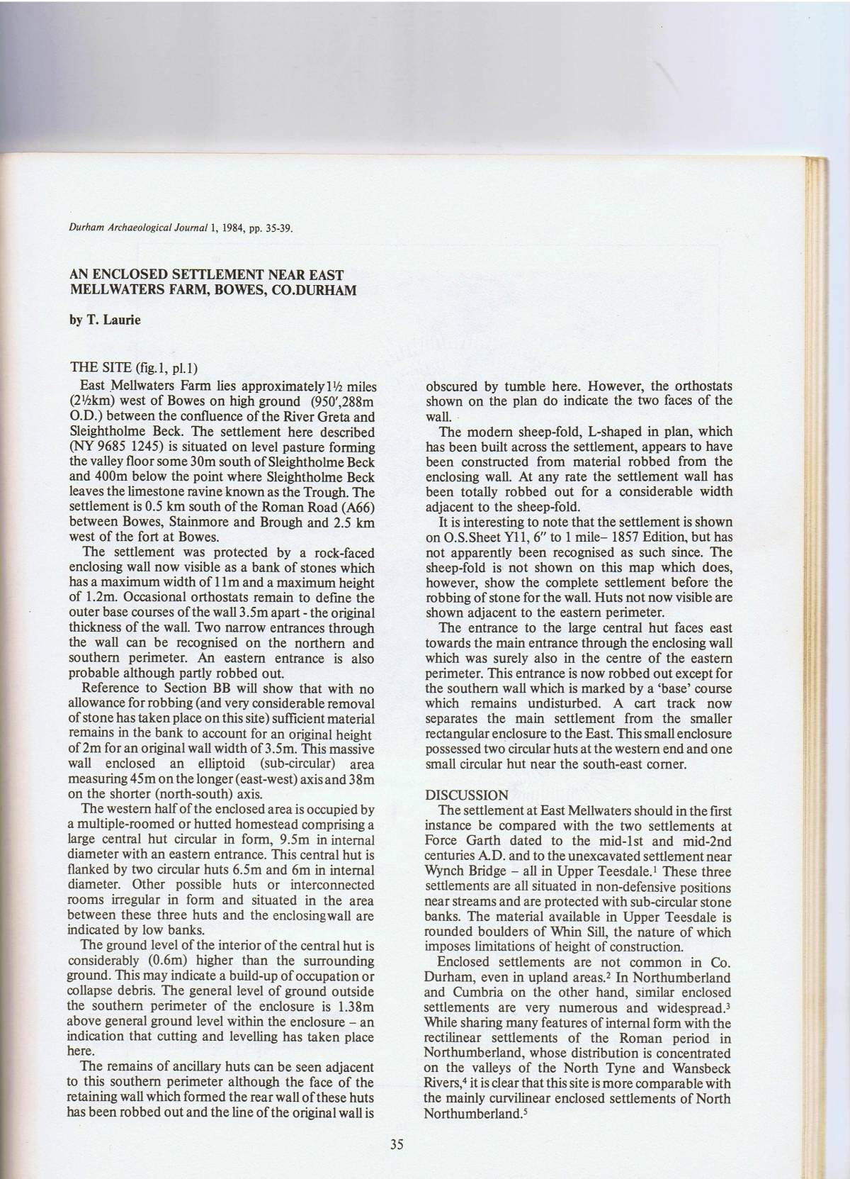
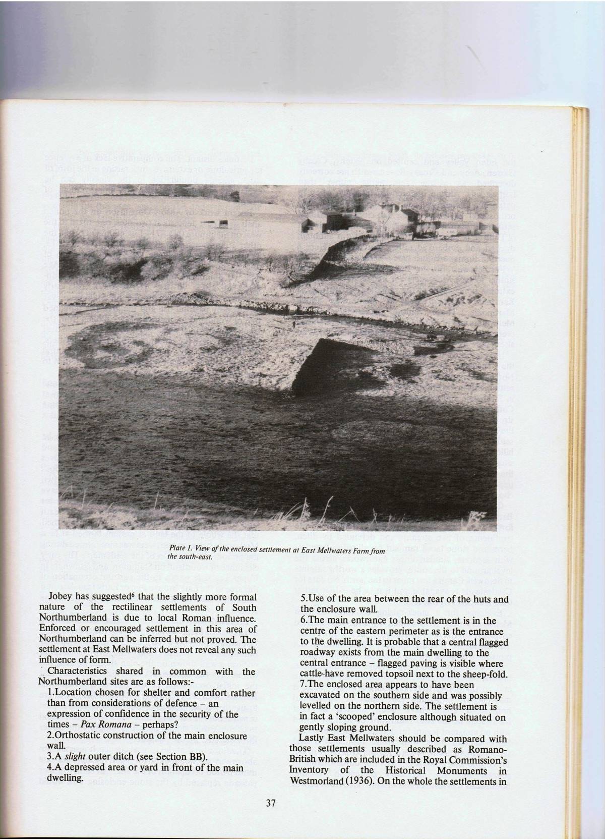
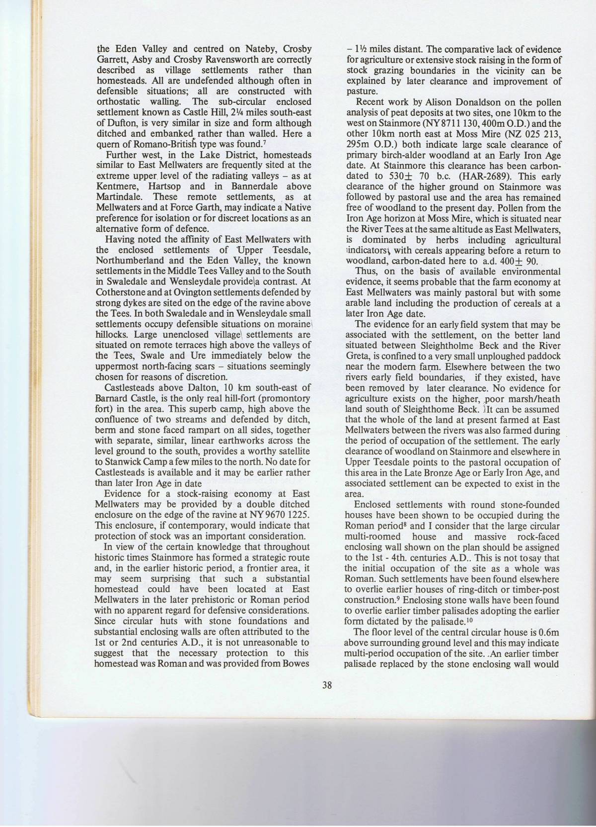
| Record Description | This well preserved curvilinear settlement has been surveyed and fully described, see Laurie, T.C. 1984. Durham Archaeological Journal Volume 1, pp 35-39 (see plan and article attached).
The cluster of bank and ditched enclosures at NYxxyy (centre) the top of the ravine could be stock pens associated with this settlement. The extensive complex of levelled settlement platforms, enclosures in the grass paddock close to the Farm and the field system in pastures between Sleightholme Beck and the Greta are likely to be later (Medieval?) in date.
All these later features at East Mellwaters have subsequently been surveyed within the A66 Project. |
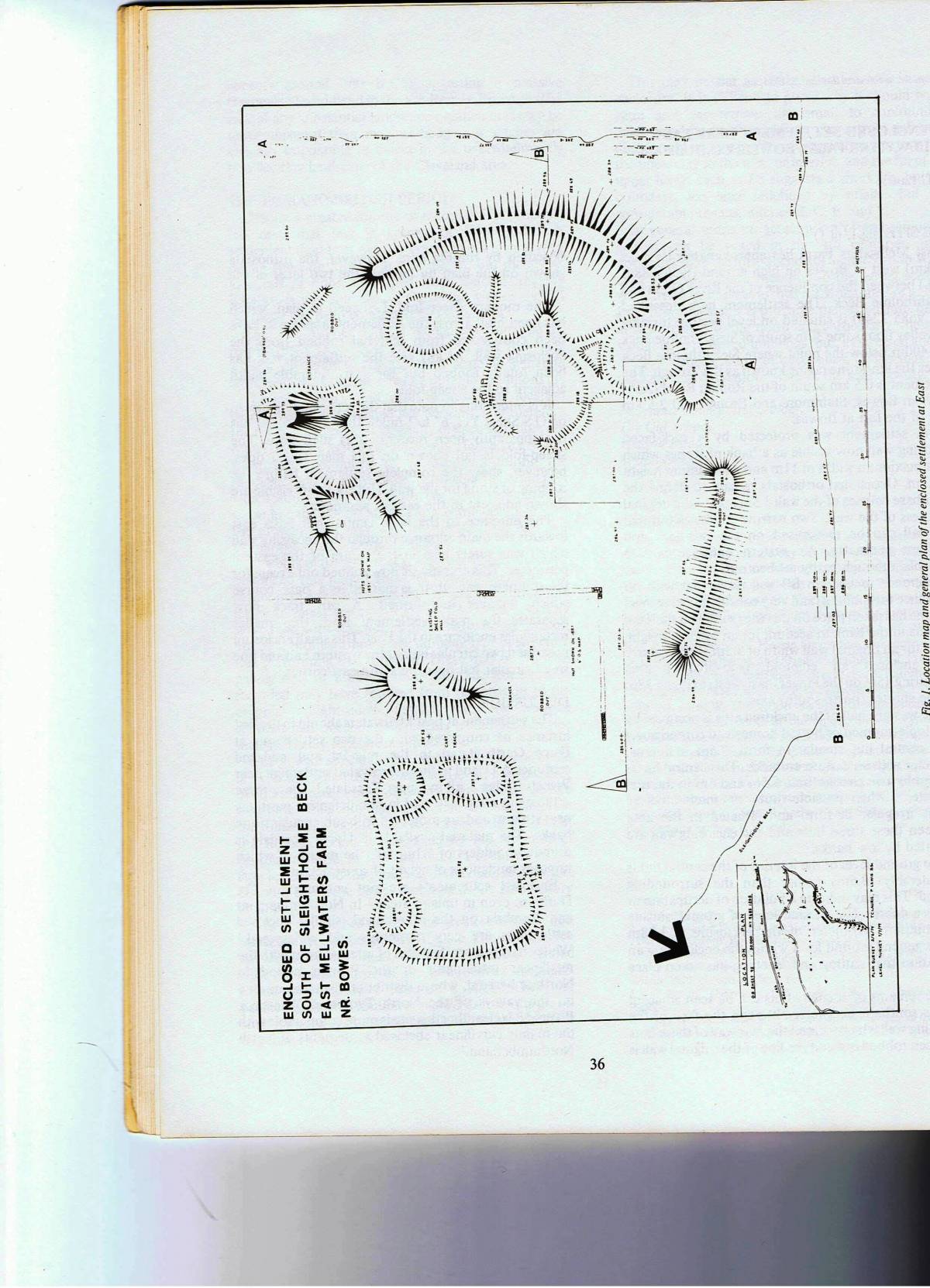
| Dimensions | Enclosing bank 11m wide. Area enclosed 45m*38m. Central round house 9.5m internal diameter. |
| Additional Notes | The significance of this Native Farmstead Settlement of Late Prehistoric Iron Age or Roman lies in its location some 2.5km west of the Roman Fort at Bowes. The complete absence of any pottery finds from the numerous molehills on this site points to an earlier, native Iron Age aceramic occupation rater than to Roman Period occupation.
East Mellwaters Farm is on the route of the Pennine Way Bowes Diversion and East Mellwaters Farm has an extremely well designed system of open access footpaths enabling easy walking around the whole farm which is so beautifilly situated between Sleightholme Beck and The River Greta. |
| Image 1 ID | 2904 Click image to enlarge |
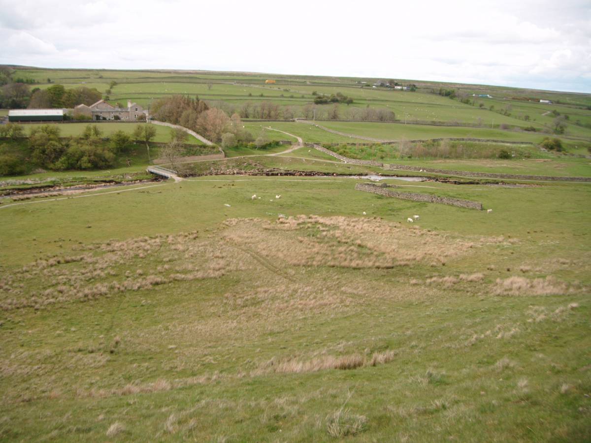
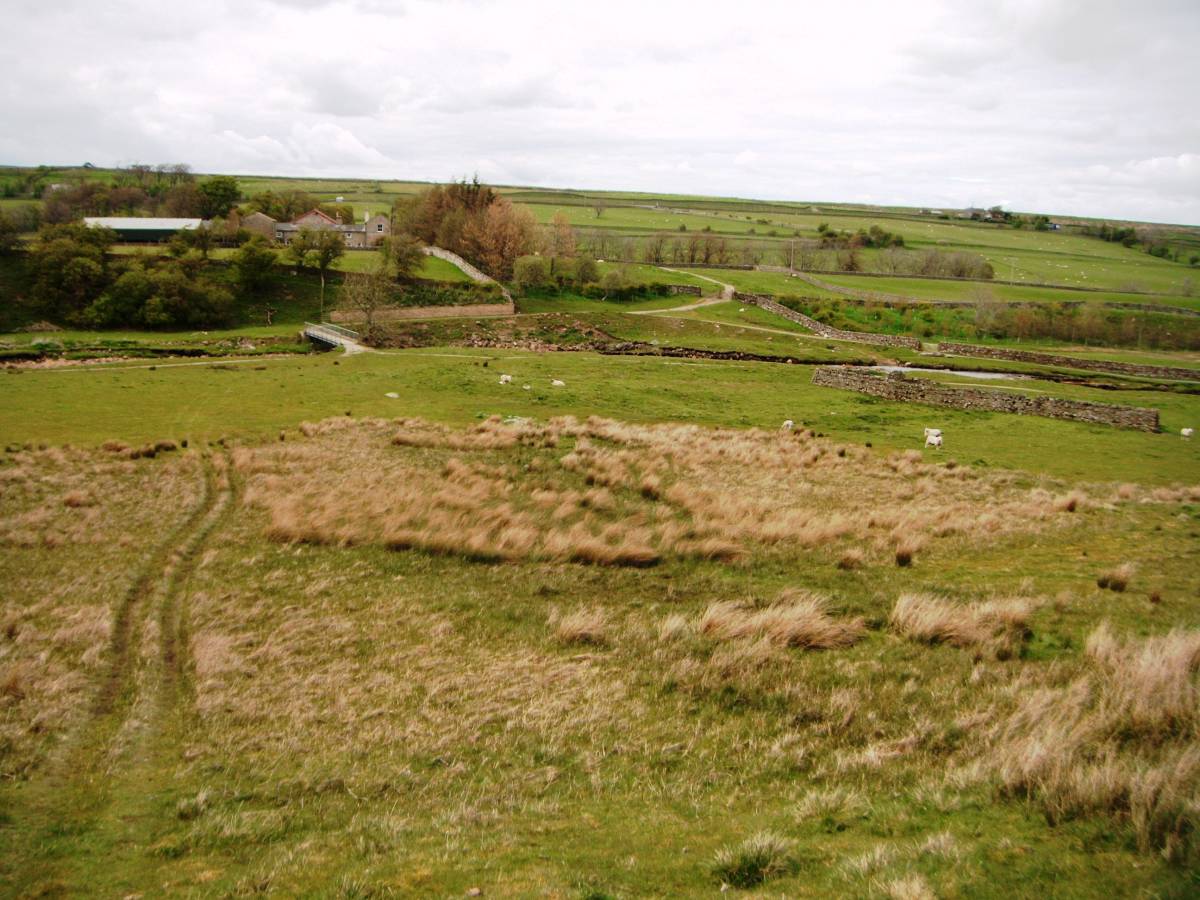
| Image 1 Description | East Mellwaters Farm with Native Iron Age Settlement close to the sheepfold, centre. |  |
| Image 2 ID | 2898 Click image to enlarge |
| Image 2 Description | Reference: The Durham Archaeological Journal, Volume 1 1984, pp 35-39 (Laurie, T.C. 'An Enclosed Settlement near East Mellwaters Farm, Bowes, Co. Durham.' |  |
| Image 3 ID | 2899 Click image to enlarge |
| Image 3 Description | |  |
| Image 4 ID | 2900 Click image to enlarge |
| Image 4 Description | Plane Table Survey Plan and Section. |  |
| Image 5 ID | 2901 Click image to enlarge |
| Image 5 Description | | 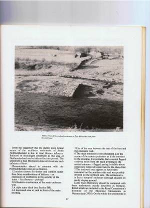 |
| Image 6 ID | 2902 Click image to enlarge |
| Image 6 Description | | 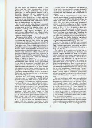 |
| Image 7 ID | 2903 Click image to enlarge |
| Image 7 Description | |  |
| Image 8 ID | 2895 Click image to enlarge |
| Image 8 Description | |  |
| Image 9 ID | 2896 Click image to enlarge |
| Image 9 Description | | 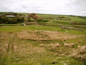 |
| Image 10 ID | 2897 Click image to enlarge |
| Image 10 Description | | 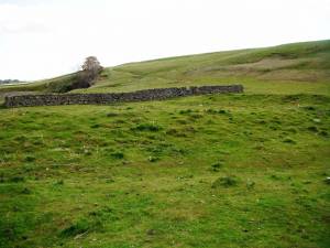 |